Wellcome to National Portal
Text size A A A
Color C C C C

সর্ব-শেষ হাল-নাগাদ: ৪ অক্টোবর ২০২৩

মোঃ জাকারিয়া

মোঃ জাকারিয়া

সিনিয়র সায়েন্টিফিক অফিসার ও বিভাগীয় প্রধান

ভূতাত্ত্বিক ওশানোগ্রাফি বিভাগ

ইমেইল: zakaria@bori.gov.bd

অফিস ফোনঃ +৮৮০৩৪১৫২৫৫২

মোবাইল: +৮৮০১৯১৭০১৯৮৩৮  

He is doing research on geological oceanography field focused on Sedimentology, relative tectonics and basin analysis in the Bay of Bengal area. In the early career, he was involved in the GIS & Remote Sensing, Statistical modeling in geology field. Now he is working on geological oceanography where he is doing research on Sedimentology, tectonics and coastal geomorphological study. He has exclusive project development and management career in the scientific field. He visited different country for the purpose of oceanography training, institutional collaboration and development in India, Malaysia and China. He is very young, energetic and motivated to do extensive field work, research and innovation in the field of geological oceanography.         


মূল দক্ষতাসমূহঃ


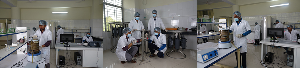
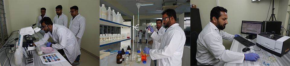
  • Research ability in Geology, Oceanography and Remote Sensing & GIS
  • Teaching experience in GIS field;
  • Extensive professional experience in ArcGIS 10x, QGIS, AutoCAD, Rockware, Illustrator, Adobe Flash Professional, Photoshop CS.
  • Educational experience in many geophysical and structural geological software, such as Stereo Win, Schlum, Mag2dc, Gav2dc, SeisVision, Potent etc.
  • Ability to conduct marine and geological field survey
  • Ability to sell concepts and successfully negotiate terms. Excellent training and presentation skill using audio visual aids.


বর্তমান পদবীঃ 


2018 – Present:              Senior Scientific Officer and Divisional Head of Geological Oceanography Division in Bangladesh Oceanographic Research

                                Institute (BORI) under Ministry of Science and Technology, Bangladesh.


পূর্ববর্তী কর্ম অভিজ্ঞতা: 


2014–2017:                    Scientific Officer at National Oceanographic Research Establishment (1st Phase) Project (NORIP) under Ministry of Science and

                                Technology, Bangladesh

2013-2014:                    GIS Analyst in Agricultural Statistics Division of Bangladesh Rice Research Institute (BRRI) under Food for Progress (FFP) project

                                of USDA

2012-2013:                    GIS Specialist in Agricultural Statistics Division of Bangladesh Rice Research Institute (BRRI), Ministry of Agriculture


শিক্ষকতা যোগ্যতা:


2009-2010:                     Master’s of Science (M.S) in Geological Sciences, Jahangirnagar University, Bangladesh. 

2006-2009:                     Bachelor of Science (B.Sc), Honours in Geological Sciences, Jahangirnagar University, Bangladesh. 


বর্তমান গবেষণা ক্ষেত্র:


  • Master’s project report on “Developing Conceptual Aquifer Geometry and Analysis of Structural Geological Control on Sea Water Intrusion of Cox’s Bazar Area, Cox’s Bazar, CHT, Bangladesh” Supervisor: Mazeda Islam, Associate Professor, Department of Geological Sciences, Jahangirnagar University.
  • Completed research project on “Delineation of Tectonic Activity effect on Relative Sea Level Fluctuation on the basis of Subsidence, Upliftment and Compaction rate of the Eastern Coastal Belt of Bangladesh”, Duration: July, 2019 - June, 2020. Financed by: Bangladesh Oceanographic Research Institute (BORI), Ministry of Science and Technology, Bangladesh.
  • Completed research project on Determination of Sedimentological & Mineralogical Composition and Sediment Province Analysis of the Nearshore Area of Saint Martin Island, Bangladesh, Duration: January, 2018 - June, 2018. Financed by: Bangladesh Oceanographic Research Institute (BORI)
  • Completed research project on Determination of Sedimentological & Mineralogical Distribution and Sediment Province of the Nearshore Area of Cox’s Bazar-Teknaf, Bangladesh, Duration: July, 2018 – June, 2019. Financed by: Bangladesh Oceanographic Research Institute (BORI) 
  • Completed research activity on "Delineation of Landslide Prone Area from Morphometric Analysis using Geographic Information System (GIS) in the Cox's Bazar area of Bangladesh" during 2018-2019 FY, Financed by: Ministry of Science and Technology under R7D special allocation
  • At-Sea field work on Bay of Bengal arranged by Bangladesh Navy Ship RV Saibal during 31 March to 6 April, 2018. Programme: Bangladesh Navy Hydrographic Survey
  • Surveyed about 3000 sq. kilometer nearshore and coastal sea area of Bay of Bengal during 2018-2019 research activity by boat. Programme: Sea Bed Sediment Sample Collection for R&D Project  
  • Sedimentological field work in Kaptai-Rangamati area of Chittagong district, Bangladesh in 2010 as a B.Sc 4th year field report. Supervisor: Professor Dr. Julleh Jalalur Rahman, Jahangirnagar University, Savar, Dhaka-1342.
  • Stratigraphical field work in the Jaintiapur and its adjoining area of Sylhet district, Bangladesh in 2009 as a B.Sc 3rd year field report. Supervisor: Professor, Dr. khalillur Rahman Chowdhury, Jahangirnagar University, Savar, Dhaka-1342.
  • Structural Geological field work in the Sitakund and its adjoining area of Chitagong district, Bangladesh in 2008 as a B.Sc 2nd year field report. Supervisor: Associated prof. Dr. Sharif Hossain Khan, Jahangirnagar University, Savar, Dhaka-1342.


প্রশিক্ষণ ও কর্মশালা:


  • Participant on the conference named “Coastal and ocean processes in the Bay of Bengal in a changing climate and their impacts on society” during 12-18 October, 2014, Organized by Nansen-Bangladesh International Center for Coastal, Ocean and Climate Studies (NABIC), Nansen Scientific Society, Norway.
  • Completed a training course on “Subsoil Investigation” in Engineering Staff College, Bangladesh (a corporate body of the Institute of Engineers, Bangladesh) held on 01-02 November, 2019.
  • Completed 20 days 2018 Overseas Training Program on Marine Spatial Planning for Bangladesh, organized by Blue Economy Cell, Ministry of Science and Technology, Bangladesh and Fujian Institute of Oceanography (FJIO), China held on 10-29 October, 2019. 
  • Successfully complete the “English for IELTS” course at the level of Upper Intermediate (IELTS level 5.5-6.5) during 20 July-29 September, 2019 in the British Council.
  • Participated in the training on “Special Foundation for Non-Cadre Officers” during 11 June-09 August, 2019 periods in National Academy for Planning & Development (NAPD) under Ministry of Planning, Bangladesh.
  • Participated on the workshop titled "Blue Economy and EU Horizon 2020" Organized by Ministry of Foreign Affairs, Bangladesh and European Union Delegation, Dhaka on 25th November, 2018.
  • Completed training on Ocean Research: Basic of Observation and Instrumentations held in CSIR-National Institute of Oceanography (CSIR-NIO), Goa, India during 16-30 August, 2018
  • Participant on the conference named "Bangladesh Ocean Conference: National Consultation on SDG14: Life Below Water", Organized by Ministry of Foreign Affairs, Bangladesh and UNDP on 1st June, 2017 at Pan Pacific Sonargaon Hotel, Dhaka.
  • Completed 13th training course on "Oceanography: Principles and Applications" Organized by National Oceanographic and Maritime Institute (NOAMI) under the auspices of Ministry of Science and Technology, Bangladesh during 1st April to 24th July, 2017.
  • Complete the Procuring Entity (PE) Training on National e-Government Procurement (e-GP) Portal as Procuring Entity (PE) User during 13-15 May, 2017. Organized by CPTU, IMED, Ministry of Planning, Bangladesh.


বৈজ্ঞানিক প্রবন্ধ: 


  • Zakaria, M. and Islam, M. T. (2019c), Analysis of Relative Tectonic Activity using Morphometric parameter of the Reju Khal Drainage Basin of Cox’s Bazar, Bangladesh, The Journal of NOAMI, Vol. 36, Number 1, June 2019. 
  • Islam, M.T. and Zakaria, M., (2019b), Forecasting of Maximum and Minimum Temperature in the Cox’s Bazar Region of Bangladesh based on Time Series Analysis, IOSR Journal of Mathematics (IOSR-JM), Vol. 15 (5), pp. 56-67. DOI: 10.9790/5728-1505035667
  • Islam, M.T. and Zakaria, M., (2019a), Interdependency between Rainfall and Temperature using Correlation Analysis in the Barishal District of Bangladesh, IOSR Journal of Mathematics (IOSR-JM), Vol. 15 (5), pp. 49-55. DOI: 10.9790/5728-1505034955
  • Zakaria, M. and Majumder, M. A. K. (2017), A comparison between Regular Square Grid and Basin or Sub-basin based analysis of Hypsometric Integral: A Case study for Maheshkhali, Inani & Dakshin Nhila Anticline of Cox’s Bazar, Bangladesh, International Journal of Scientific & Engineering Research, Volume 8, Issue 6, pp. 1425-1430.
  • Zakaria, M., Majumder, M. A. K. & Rahman, M. M., (2016), Morphometric Analysis of Reju Khal Drainage Basin using Geographic Information System (GIS) and SRTM data, International Journal of Scientific & Engineering Research, Volume 7, Issue 6, pp. 461-470.
  • Zakaria, M., Islam, M. & Rahman, M.M., (2015), Developing Conceptual Aquifer Geometry, Structural Geological Control and Possibility of Sea Water Intrusion in Cox’s Bazar Area of Bangladesh, IOSR Journal of Applied Geology and Geophysics (IOSR-JAGG, e-ISSN: 2321–0990, p-ISSN: 2321–0982.Volume 3, Issue 6 Ver. III, PP 21-28. DOI: 10.9790/0990-03632128
  • Zakaria, M., Aziz, M.A., Hossain, M.I., & Rahman, N.M.F., (2014), Effects Of Rainfall And Maximum Temperature On Aman Rice Production Of Bangladesh: A Case Study For Last Decade, International Journal Of Scientific & Technology Research Volume 3, Issue 2, pp. 131-137.


পুরস্কারঃ


  • Selected at the top 5 first ranked trainee on 30 days at sea training programme in Deep Ocean Resources Development Co. Ltd., Japan. Organized by:  International Seabed Authority (ISA), Jamaica, USA. Link: https://www.isa.org.jm/training/contractor-training/deep-ocean-resources-development-co-ltd-japan
  • Received best “Suddhachar” (Virtuousness & Integrity) Employee Award on 2018-2019 period of Bangladesh Oceanographic Research Institute (BORI), Ministry of Science and Technology.
  • Awarded as a Principal Investigator for R&D Special Allocation by Ministry of Science and Technology, Bangladesh on the project titled “Delineation of Landslide Prone Area from Morphometric Analysis using Geographic Information System (GIS) in the Cox's Bazar area of Bangladesh”.